The Environmental Impact Assessment (EIA) will assess the effects of the Proposed Development on the water and soils environment, including the peatland resources at the Site.
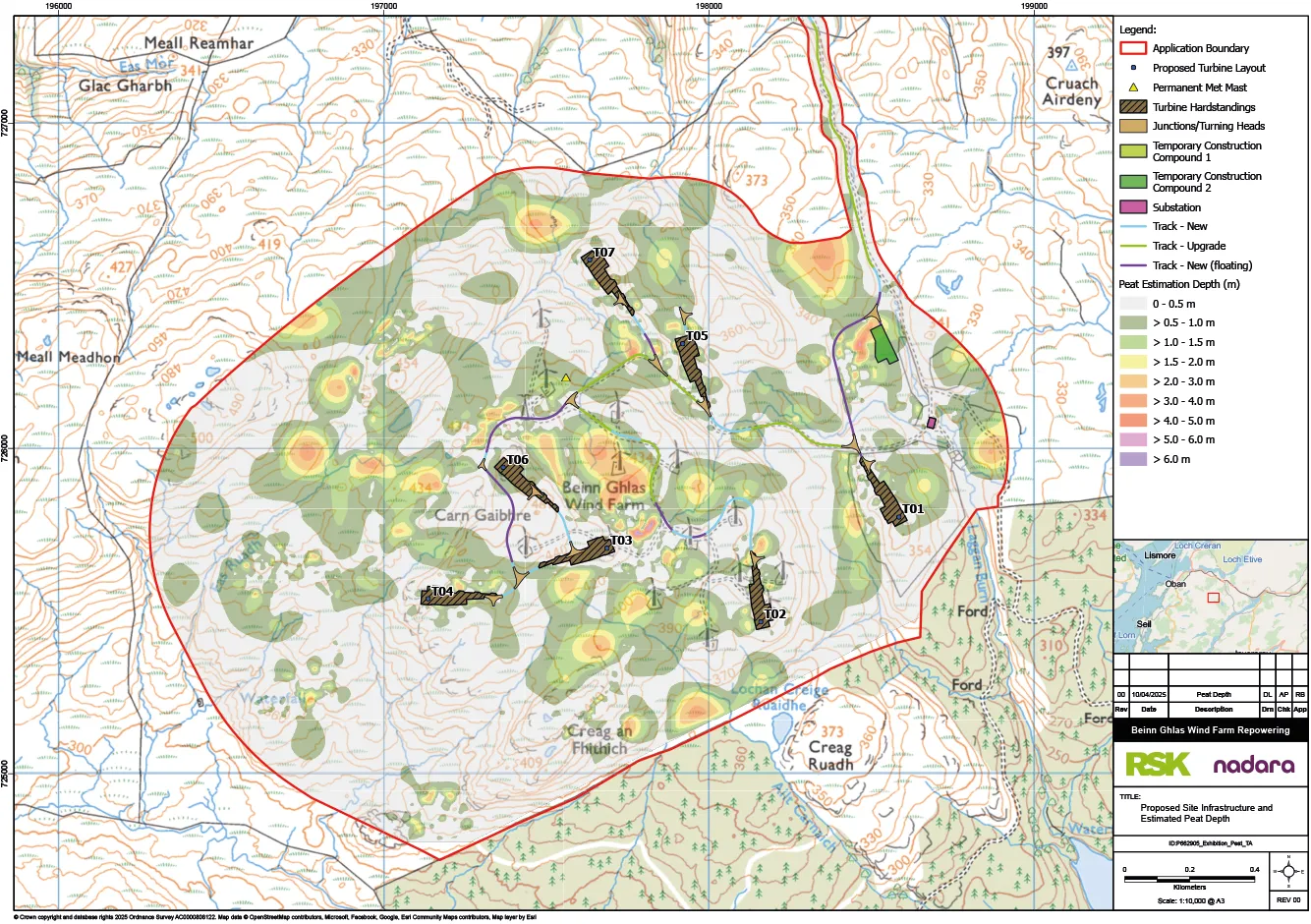
The proposed site infrastructure and estimated peat depth recorded from the peat surveys are shown on the figure above.
Potential impacts on surface water and groundwater quality and quantity including associated receptors such as Groundwater Dependent Terrestrial Ecosystems (GWDTE), private and public water supplies, aquatic species, and disturbance of peat and carbon rich soils will be considered in the Environmental Impact Assessment Report (EIAR).
Various peat depth surveys have been completed at increasingly higher resolution to define the variation in peat across the Site and in the vicinity of the Proposed Development. Peat is present across the Site in pockets separated by areas of soils and outcropping bedrock. Where possible the Proposed Development has either used existing infrastructure or has avoided peat.
Where excavation of peat cannot be avoided the best quality peat will be translocated directly to areas of peat erosion for restoration.
There are a number of watercourses that radiate off the Site to the River Nant in the south, the Feochan Mhor/River Nell catchment in the west and the Allt Nathais and Allt na h-Airde catchments both in the north. The infrastructure has been designed to avoid watercourses, as shown on 1:50,000, 1:25,000 and 1:10,000 Ordnance Survey mapping, including a 50 m buffer zone, with exceptions occurring mainly where watercourse crossings are required, or existing tracks are upgraded.
The watercourse crossings have been limited to five new crossings with 22 upgraded existing crossings.
The majority of the Site has no risk of river flooding although some areas located in close proximity to watercourses show a medium to high risk of flooding. These areas have been identified and avoided.
There are two private water supplies in proximity to the upgraded access track that could be affected by the Proposed Development. These supplies will be protected and alternative sources provided during construction if necessary.
The geology of the site is impermeable and therefore groundwater is only present in small quantities, mainly in the upper weathered layer resulting in no extensive areas of GWDTE. In a number of locations this groundwater supports some very small flush habitats that are classified as groundwater dependent. Some impact on a minor number of these features is anticipated however none were observed to feed into larger GWDTEs and therefore impacts will be limited to these features themselves, which are small and of relatively low limited ecological importance individually.