The Zone of Theoretical Visibility (ZTV) is a computer-generated diagram that illustrates areas from where the proposed wind turbines may be seen.
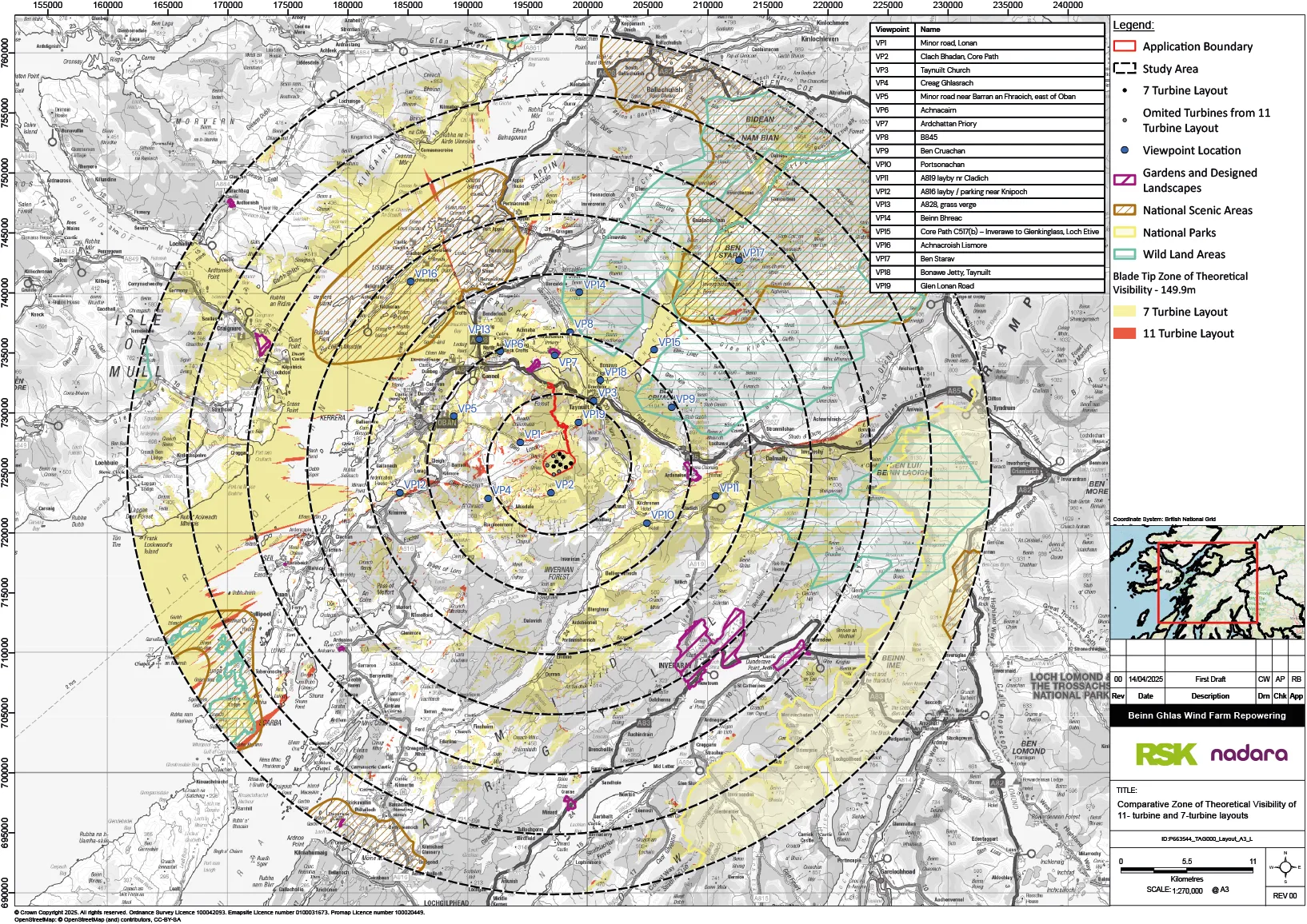
The different colours shown on the diagram indicate the number of turbines that may be seen, as shown on the legend. The areas from where the wind turbines will not be visible (because they are hidden by hills and other landforms) have no coloured shading.
The zone of theoretical visibility (ZTV) shown here extends to a radius of 35 km from the wind farm. This covers the study area that will be considered in the LVIA for the wind turbines, in accordance with the guidance published by NatureScot.
The ZTV diagram is based on landform only, and does not take account of the forestry, woodland and buildings which can screen views of the Proposed Development. This means that many areas that are shown on the ZTV to have theoretical visibility of turbines will not in fact have any visibility.
The ZTV shows the locations of viewpoints that have been used to analyse the visibility of the wind turbines. These viewpoints have been selected through site visits made by the project team and following requests from NatureScot and Argyll and Bute Council. Views from some of these viewpoint locations are shown on the exhibition boards.