
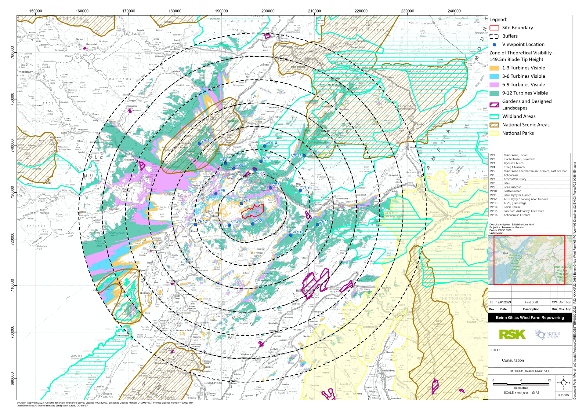
The Zone of Theoretical Visibility (to blade tip)
Landscape and Visual Impact Assessment
A Landscape and Visual Impact Assessment (LVIA) will be undertaken to analyse and identify the potential effects that the wind farm will have on views from the surrounding area and the landscape character of areas around the wind farm. This assessment will include consideration of effects on views from settlements, walking routes, roads, visitor destinations, hilltops, and other relevant locations. Specific assessments will be carried out for the effects of the wind farm on views seen by local residents and on the ‘Special Qualities’ of National Scenic Areas (NSAs) and wildland qualities of Wild Lane Areas (WLAs).
Zone of Theoretical Visibility
The Zone of Theoretical Visibility (ZTV) is a computer-generated diagram that illustrates areas from where the proposed wind farm may be seen. The different colours shown on the diagram indicate the number of turbines that may be seen, as shown on the legend. The areas from where the wind farm will not be visible – because it is hidden by hills and other landforms – have no coloured shading.
This diagram is based on landform only, and does not take account of the forestry, woodland and buildings that can also screen views of the wind farm. This means that many of the areas that are shown on the ZTV to have theoretical views of the wind farm will not in fact have any visibility.
The ZTV diagram shown here extends to a radius of 35 km from the wind farm. This covers the Study Area that will be considered in the LVIA for the wind farm, in accordance with guidance published by NatureScot.
The ZTV shows the locations of 16 viewpoints that will be used to analyse the visibility of the wind farm. These viewpoints have been selected through site visits made by the project team.
Views from six of these viewpoint locations are displayed here.
The photomontage views on the exhibition boards are created using photographs taken at the viewpoint locations specifically for the purpose of creating these visualisations. The wind farm is then superimposed onto the photographs using a computer-generated model. The photography and modelling of the wind farm as shown in the photomontages has been carried out in accordance with guidance produced by NatureScot however the visual presentation of these is for exhibition purposes only.